


409B-Voting District, Clay County, Florida
About
Outline

Summary
| Unique Area Identifier | 552441 |
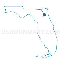
| Name | 409B-Voting District |
| County | Clay County |
| State | Florida |
| Area (square miles) | 0.32 |
| Land Area (square miles) | 0.32 |
| Water Area (square miles) | 0.00 |
| % of Land Area | 100.00 |
| % of Water Area | 0.00 |
| Latitude of the Internal Point | 30.09147680 |
| Longtitude of the Internal Point | -81.72027380 |
Maps


Graphs
Select a template below for downloading or customizing gragh for 409B-Voting District, Clay County, Florida


Neighbors
Neighoring Voting District (by Name) Neighboring Voting District on the Map
- 409FIA-Voting District (Fleming Island Plantation CDD), Clay County, FL
- 409FIP-Voting District (Fleming Island Plantation CDD), Clay County, FL
- 409XDD-Voting District (The Crossings @ Fleming Island CDD), Clay County, FL
- 410B-Voting District, Clay County, FL
- 412XDD-Voting District (The Crossings @ Fleming Island CDD), Clay County, FL